搜尋結果
Google Maps is a web mapping platform and consumer application offered by Google. It offers satellite imagery, aerial photography, street maps, 360° interactive panoramic views of streets (Street View), real-time traffic conditions, and route planning for traveling by foot, car, bike, air (in beta) and public transportation.
- Google Maps相關熱搜 - Yahoo奇摩搜尋結果
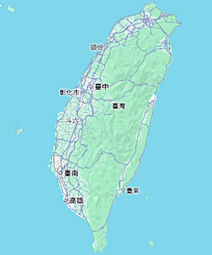
[n] The main island of Taiwan, also known as Formosa, lies between the East and South China Seas in the northwestern Pacific Ocean, with the People's Republic of China (PRC) to the northwest, Japan to the northeast, and the Philippines to the south.
Map of eastern Taipei (labeled as TAIHOKU) and nearby areas (AMS, 1944) The Taihoku Prefecture government building in the 1910s (now the Control Yuan building) As settlement for losing the First Sino-Japanese War, China ceded the island of Taiwan to the .
其他人也問了
How does Google Earth map the Earth?
Where is Taiwan located?
What is my maps in Google Maps?
Where is Taipei located?
- Route Description
- Major Cities and Districts Along The Route
- Spur Routes
The entire highway is known as The Northern Coastal Highway (北部濱海公路) or simply Coastal Highway (濱海公路) to the locals, although various names are given for specific stretches of the road. The stretch from Tamsui to Jinshan is also known as Tamsui-Jinshan highway (淡金公路), while the stretch from Jinshan to Keelung Cityis known as Keelung-Jinshan highway...
The highway has 7 spur routes. Each route use the same number, followed by a heavenly stemcharacter. In English, these characters are replaced by letters in alphabetical order. 1. Prov 2A (台2甲): Also known as Yangjin Highway (陽金公路) for most part, the road connects downtown Taipei to Highway 2 at Jinshan District, via Yangmingshan National Parklocat...
Google Earth is a web and computer program that renders a 3D representation of Earth based primarily on satellite imagery. The program maps the Earth by superimposing satellite images, aerial photography, and GIS data onto a 3D globe, allowing users to see
Checked. Physical map of Earth. Political map of Earth. A map is a symbolic depiction emphasizing relationships between elements of some space, such as objects, regions, or themes. Many maps are static, fixed to paper or some other durable medium, while others are dynamic or interactive.
The Global Positioning System (GPS), originally Navstar GPS, [2] is a satellite-based radio navigation system owned by the United States government and operated by the United States Space Force. [3] .
google map台灣地圖網 相關
廣告Choose Opera for Speed, Security, and Online Freedom. Try Opera Browser: your fully-featured browser for an enhanced online experience.
I'm Here to Help You with All of Your Books, Audios, and Other Useful Information. We have the technology to do so today.


