搜尋結果
 $500古書善本 民國54年 世界地圖集 第一冊 東亞諸國 張其昀主編 國防研究院印 特大本 全圖台灣古物鑑賞二館
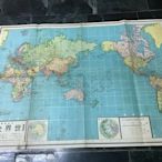
 $150早期文獻地圖,6.70年代,最新世界全圖 大張台灣古物鑑賞二館
 $150早期文獻地圖 大張 民國66年 世界全圖台灣古物鑑賞二館
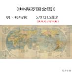
 $1164明 利瑪竇 坤輿萬國全圖紙本高清數字噴繪復制古代世界地圖國畫開心の店
![地圖【兩幅大張】水晶世界地理地圖中國地理地圖 93*69厘米背景墻 教學地圖 水晶版中國世界地理全圖掛圖 學生專用學習地 地圖【兩幅大張】水晶世界地理地圖中國地理地圖 93*69厘米背景墻 教學地圖 水晶版中國世界地理全圖掛圖 學生專用學習地]() $747地圖【兩幅大張】水晶世界地理地圖中國地理地圖 93*69厘米背景墻 教學地圖 水晶版中國世界地理全圖掛圖 學生專用學習地台灣小小百貨賣場
$747地圖【兩幅大張】水晶世界地理地圖中國地理地圖 93*69厘米背景墻 教學地圖 水晶版中國世界地理全圖掛圖 學生專用學習地台灣小小百貨賣場![精品新版 中國地圖世界地圖全圖大尺寸約2米x1.5米高清超大墻貼圖 精品新版 中國地圖世界地圖全圖大尺寸約2米x1.5米高清超大墻貼圖]() $429精品新版 中國地圖世界地圖全圖大尺寸約2米x1.5米高清超大墻貼圖Y1257239089
$429精品新版 中國地圖世界地圖全圖大尺寸約2米x1.5米高清超大墻貼圖Y1257239089![地圖世界地圖掛圖超大尺寸3米X2.2米 世界全圖 辦公室會議室用圖背景墻裝飾掛畫 中國地圖出版社掛圖 地圖世界地圖掛圖超大尺寸3米X2.2米 世界全圖 辦公室會議室用圖背景墻裝飾掛畫 中國地圖出版社掛圖]() $7130地圖世界地圖掛圖超大尺寸3米X2.2米 世界全圖 辦公室會議室用圖背景墻裝飾掛畫 中國地圖出版社掛圖台灣小小百貨賣場
$7130地圖世界地圖掛圖超大尺寸3米X2.2米 世界全圖 辦公室會議室用圖背景墻裝飾掛畫 中國地圖出版社掛圖台灣小小百貨賣場![民國63年 最新世界地圖 全圖 - 背面是各國介紹 .稀少保存美 (75*55公分) 民國63年 最新世界地圖 全圖 - 背面是各國介紹 .稀少保存美 (75*55公分)]() $1699民國63年 最新世界地圖 全圖 - 背面是各國介紹 .稀少保存美 (75*55公分)時光迴廊
$1699民國63年 最新世界地圖 全圖 - 背面是各國介紹 .稀少保存美 (75*55公分)時光迴廊![26【購物地圖】文獻 最新世界全圖地圖 街道圖 特大張 26【購物地圖】文獻 最新世界全圖地圖 街道圖 特大張]() $30026【購物地圖】文獻 最新世界全圖地圖 街道圖 特大張pro
$30026【購物地圖】文獻 最新世界全圖地圖 街道圖 特大張pro![103【地圖光觀旅遊】世界全圖 街道圖 遊覽圖 大張 103【地圖光觀旅遊】世界全圖 街道圖 遊覽圖 大張]() $150103【地圖光觀旅遊】世界全圖 街道圖 遊覽圖 大張PRO
$150103【地圖光觀旅遊】世界全圖 街道圖 遊覽圖 大張PRO![104【地圖光觀旅遊】世界全圖 街道圖 遊覽圖 大張 104【地圖光觀旅遊】世界全圖 街道圖 遊覽圖 大張]() $300104【地圖光觀旅遊】世界全圖 街道圖 遊覽圖 大張PRO
$300104【地圖光觀旅遊】世界全圖 街道圖 遊覽圖 大張PRO![13【地圖光觀旅遊】世界全圖 地圖南北極赤道 松圖出版 66年 13【地圖光觀旅遊】世界全圖 地圖南北極赤道 松圖出版 66年]() $12013【地圖光觀旅遊】世界全圖 地圖南北極赤道 松圖出版 66年PRO
$12013【地圖光觀旅遊】世界全圖 地圖南北極赤道 松圖出版 66年PRO
建立故事和地圖. With creation tools, you can draw on the map, add your photos and videos, customize your view, and share and collaborate with others.
利用「Google 地圖」尋找本地商家、檢視地圖或規劃行車路線。 When you have eliminated the JavaScript , whatever remains must be an empty page. 啟用 JavaScript 以查看 Google 地圖。
Google Maps is a powerful online map service that lets you easily find any location, plan routes, view satellite images and street views, and even explore distant planets and oceans. Whether you want to travel, navigate, learn or have fun, Google Maps can meet your needs.
全世界最詳盡的地球圖像. . 攀上最高峰。 探索世界各地的城市。 深入世界上最深邃的峽谷。 啟動 Google 地球. 在 Apple App Store 中下載 Google 地球在 Google Play 中商店下載 Google 地球啟動 Google 地球. keyboard_arrow_down. Google 地球的外觀煥然一新. 使用更簡便的操作介面來建立各種內容....
這是世界地圖網頁,提供中文版的世界地圖全圖高清版大圖,包括三維3D全球地圖(World maps)、國家分布圖,有國際全景電子地圖、世界衛星實景地圖樣式,可以在綫瀏覽、可放大。以上世界地圖,可用鼠標或手指拖移、放大、縮小。
世界地圖 是指 地球 表面的 地圖 ,一般畫有 經緯線 、地名等資料,使用者可以藉 經緯線 在 世界 地圖上找出各 地方 ,也可以知道 南極 、 北極 的位置。 有多種方法把地球表面 投影 到平面上。 早期世界地圖 [ 編輯] 主條目: 早期世界地圖. 巴比倫世界地圖 繪製於 公元前6世紀 ,是世界已知最古老的地圖 [1] 。 最早的地圖顯示出人類當時所認為的海洋包圍陸地的觀點。 中世紀 (公元300年-1300年)時期,由於羅馬教會對西方世界實行的宗教統治,製圖發展受到很大影響甚至停滯。 當時的地圖一般都把 耶路撒冷 標註在地圖的中心,有亞、歐、非三個大陸。 地圖的輪廓基本為圓形,並由四海環繞。 [2] 地理大發現 後, 美洲 納入地圖內,這樣也使世界地圖更加精確。
Earth Studio. Google 地球虛擬現實. 地球外展計劃. 從 Apple App Store 下載「Google 地球」從 Google Play 商店下載「Google 地球」 全球最細緻的地球儀. . 爬上最高的山脈。 探索世界各地城市。 走進全球最深的峽谷。 啟動「地球」 從 Apple App Store 下載「Google 地球」從...
其他人也問了
世界地圖是什麼?
如何製作世界地圖?
世界最早的地圖集是什麼?
如何下載地圖圖檔?


