搜尋結果
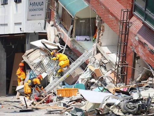
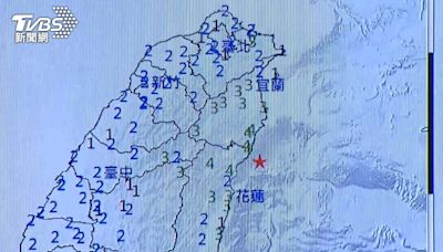
On 3 April 2024, at 07:58:11 NST (23:58:11 UTC on 2 April), a Mw 7.4 earthquake struck 16 km (9.9 mi)[3] south-southwest of Hualien City, Hualien County, Taiwan. At least 18 people were killed and over 1,100 were injured in the earthquake. It is the strongest earthquake in Taiwan since the 1999 Jiji earthquake,[4] with three aftershocks above ...
3D block diagram showing plate tectonic setting of Taiwan Taiwan is in a seismically active zone, on the Pacific Ring of Fire, and at the western edge of the Philippine Sea Plate. [1] Geologists have identified 42 active faults on the island, but most of the earthquakes detected in Taiwan are due to the convergence of the Philippine Sea plate and the Eurasian Plate to the east of the island.
其他人也問了
What was the magnitude of the Honshu earthquake?
Which fault has the longest earthquake rupture?
What is a magnitude 0 shock?
On 11 March 2011, at 14:46 JST (05:46 UTC), a Mw 9.0–9.1 undersea megathrust earthquake occurred in the Pacific Ocean, 72 km (45 mi) east of the Oshika Peninsula of the Tōhoku region. It lasted approximately six minutes, causing a tsunami. It is sometimes known in Japan as the "Great East Japan Earthquake" (東日本大震災, Higashi nihon ...
An earthquake is the shaking of the surface of Earth resulting from a sudden release of energy in the lithosphere that creates seismic waves. Earthquakes may also be referred to as quakes, tremors, or temblors. The word tremor is also used for non-earthquake seismic rumbling . In its most general sense, an earthquake is any seismic event ...
256 dead, thousands injured. Damage to the Hawkes Bay Tribune building. The 1931 Hawke's Bay earthquake, also known as the Napier earthquake, occurred in New Zealand at 10:47 am on 3 February, killing 256, [4] injuring thousands and devastating the Hawke's Bay region. It remains New Zealand's deadliest natural disaster.
The USGS provided a map of Asia in May 2008, which showed a total of 122 earthquakes occurring on the continent. The large red square near the center of the map depicts the 7.9 magnitude Chengdu quake in the Sichuan province. A USGS map shows that dozens of aftershocks occurred in a small region following the quake.
v. t. e. The Richter scale [1] ( / ˈrɪktər / ), also called the Richter magnitude scale, Richter's magnitude scale, and the Gutenberg–Richter scale, [2] is a measure of the strength of earthquakes, developed by Charles Francis Richter in collaboration with Beno Gutenberg, and presented in Richter's landmark 1935 paper, where he called it ...
